Northeastern US in 2014 -- Ancestors, Descendants, and American History, page 2
All pictures, unless otherwise noted, are copyright 2013 by John A. and Elizabeth B. Lucas. All rights reserved.
Greene County, PA Harper's Ferry, WV Baltimore and St. Michaels, MD Williamsburg and Jamestown, VA Charlottesville, VA
Skyline Drive (Shenandoah National Park), VA Hartford, CT Old Sturbridge Village, MA
Harpers Ferry, WV
Location: 39.325278, -77.743611
Wikipedia
Harpers Ferry National Historical Park
Topography has shaped the history of Harpers Ferry. It is located at the confluence of the Potomac and Shenandoah Rives and coincides with the Potomac piercing the Blue Ridge in a water gap. This made it a natural water level route from Baltimore and Washington to the agriculture of the Shenandoah Valley and coal mines of what became West Virginia when it seceded from Virginia in 1863. The gorge at Harper's Ferry was narrow enough that it really wasn't conducive to the westward migration using wagons. But there was enough room for a canal and a railroad or two, and the change in elevation with rapids meant that water-powered industries could also take advantage of the location.
Thus, by mid-19th century, Harpers Ferry was a transportation and industrial hub and a strategic prize in war.
A brief summary of events:
1783 Thomas Jefferson visits Harpers Ferry and calls it "one of the most stupendous scenes in Nature"
1834 Chesapeake and Ohio Canal reaches Harpers Ferry from Washington, DC
1837 Baltimore and Ohio Railroad reaches Harpers Ferry from Baltimore, MD
1859 John Brown and other abolitionists attack the United States Armory and Arsenal in an attempt to arm an uprising of slaves
1862 "Stonewall" Jackson captures 12700 Union troops, 13,000 arms and 47 pieces of artillery
Today, there is a small modern town on the heights while the "lower town" is partly restored to a mid-19th century style. The railroad is still there and divides as it crosses the Potomac, following each river. The canal is long gone except for the footpath. The Appalachian National Scenic Trail uses the railroad bridge to cross the Potomac between Maryland (and the northeastern US) and West Virginia (and the southeastern US). The trail then crosses the Shenandoah River into Virginia to follow the Blue Ridge south.

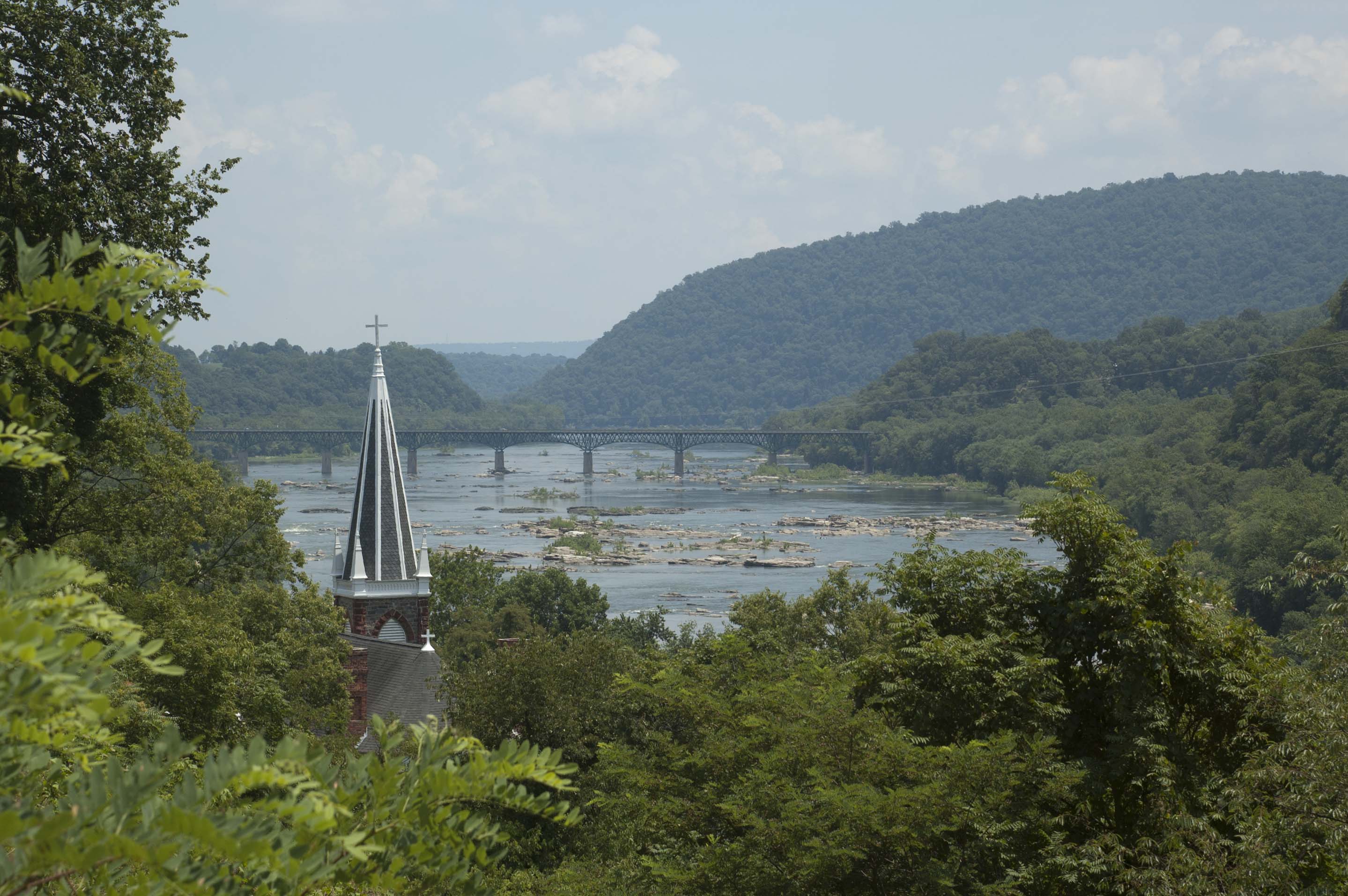
Looking east (downstream) at the Potomac River gorge. The Shenandoah River flows in from the right side; the western Potomac flows in from the left. The bridge is a highway bridge. The prominent ridge is the Blue Ridge. The shot was taken from the Bolivar Heights which were used for artillery batteries.
This is a water-level view from the railway bridge.
And here is the railroad bridge with the walkway for the Appalachian Trail, looking from West Virginia to Maryland.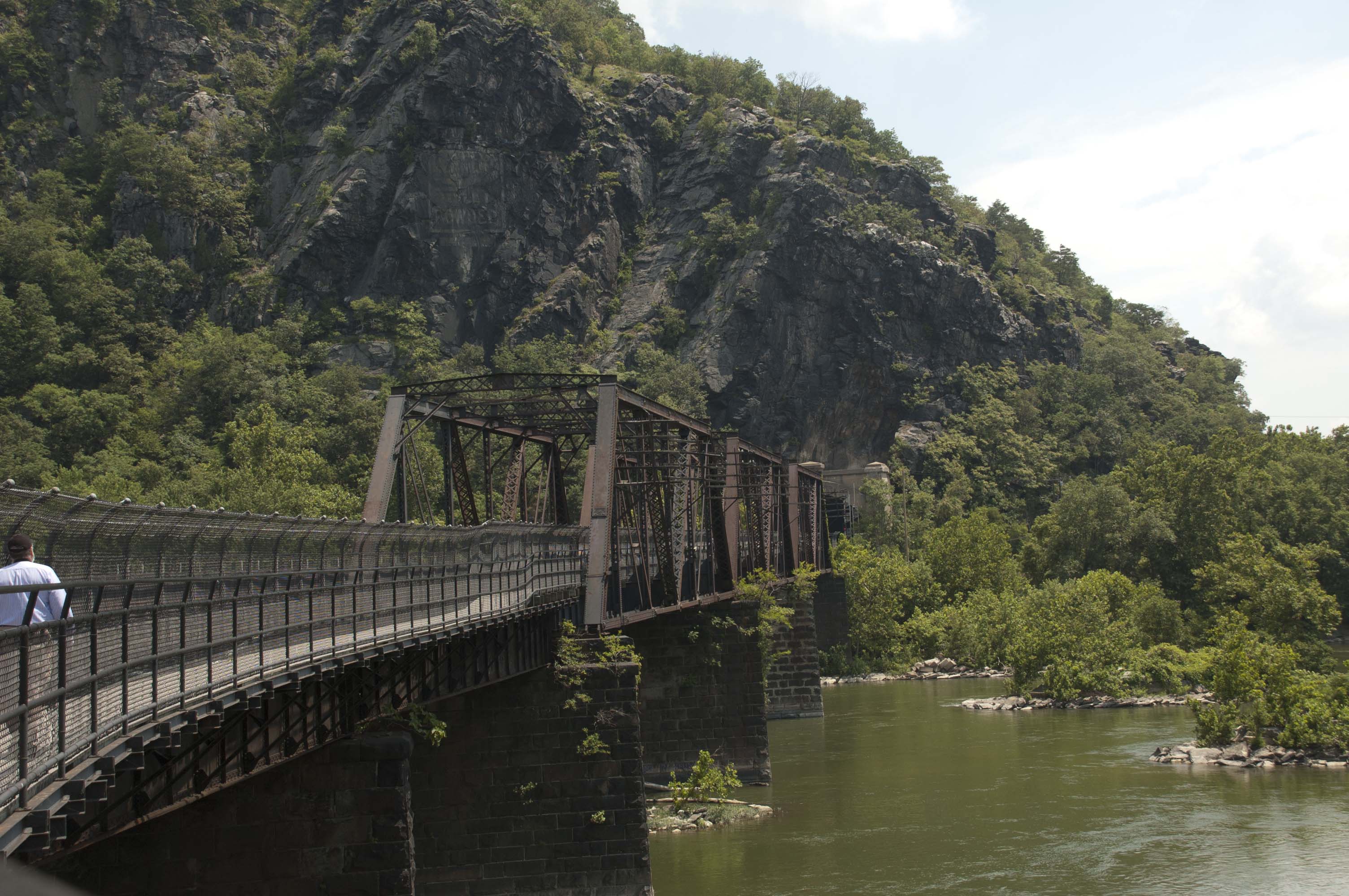
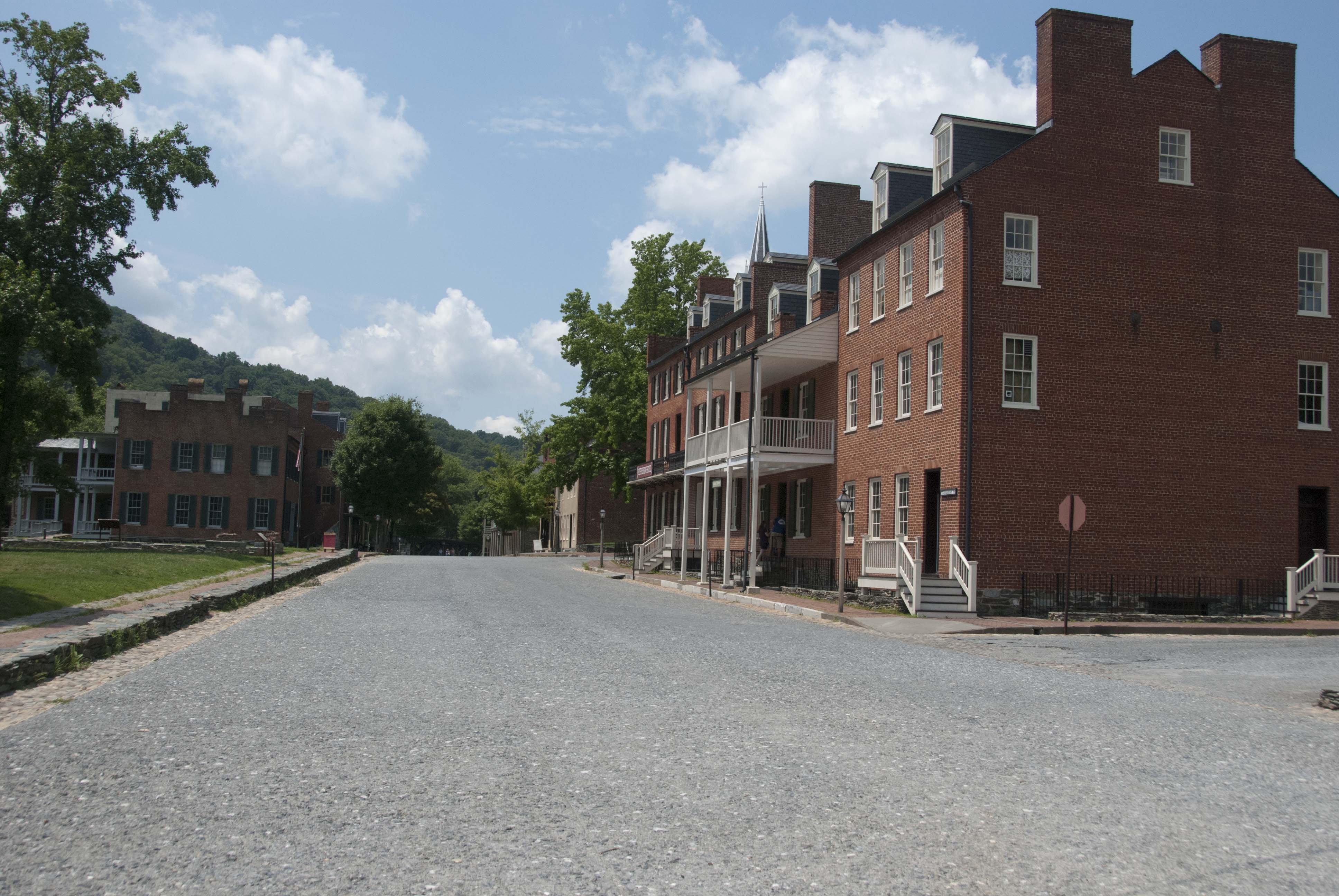
Shops in the lower town.

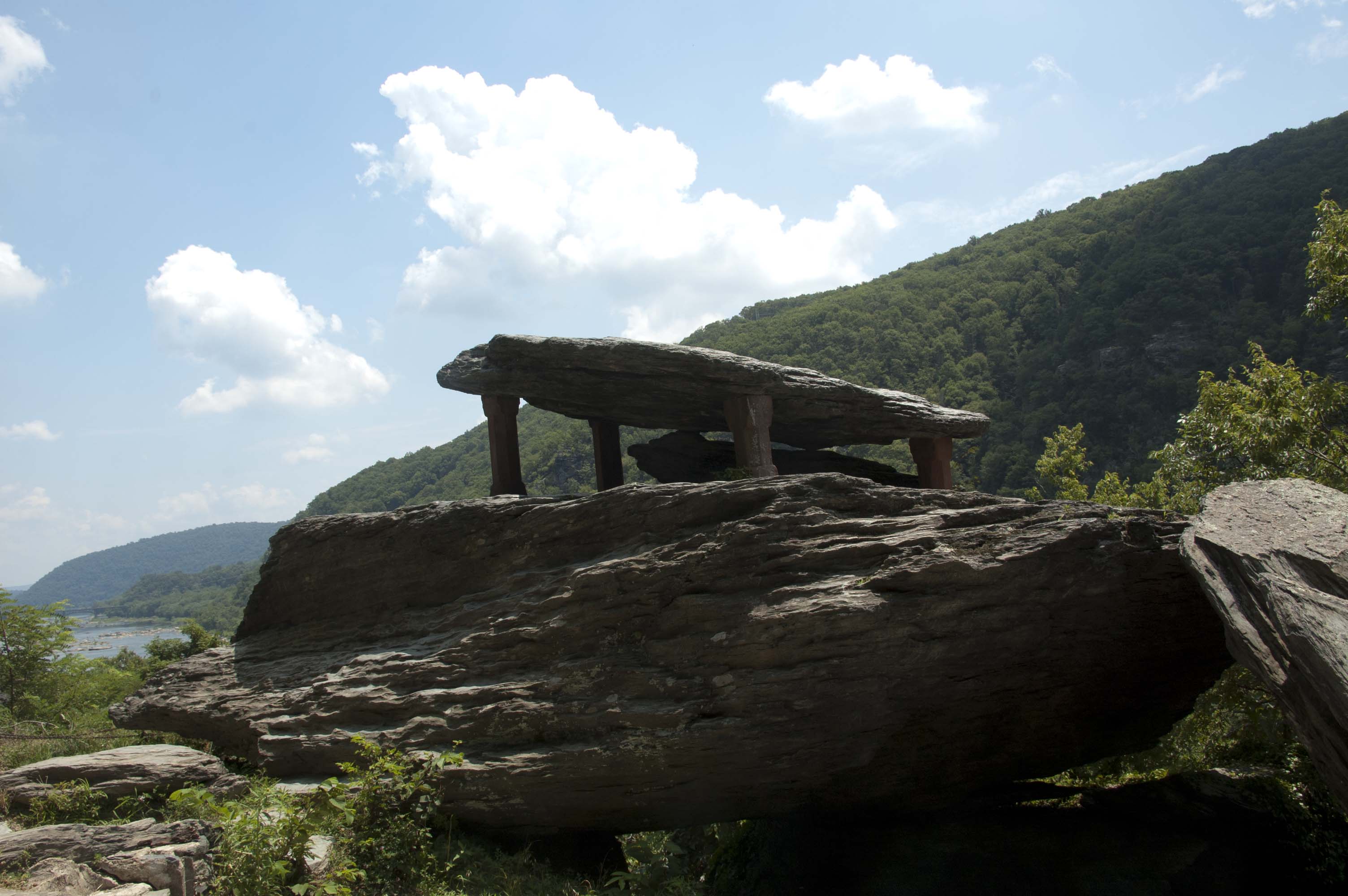
Then Beth said, "Why don't we hike to Jefferson's Rock? It's only a half mile or so." You have been noticing the terrain around here, haven't you? This was a very warm and very humid day, but we persevered. Readers should not worry that we weren't getting enough cardiovascular activity on the trip! And then, of course, we were insufferably smug on the way down as we passed a large group of teenagers whining their way uphill. "We did it, so can you!"
We drove to Harpers Ferry from Waynesburg, Pennsylvania arriving before lunch and en route to Baltimore, Maryland for the next phase of our trip. We paid our $10 entrance fee only to have it converted into a Lifetime Senior Pass giving free admission to national parks and monuments coast to coast for the holder and up to three guests. Now THAT's a deal if you plan to use Department of the Interior locations in your later years. We were to use it again for free admission later at Skyline Drive. There are some compensations for getting old.
Next